Spatial Computing Applications: Guide to Uses, Systems, and Important Details
Spatial computing applications allow computers to understand physical space and place digital information within or around that space. Instead of interacting only with a flat screen, users can work with three-dimensional objects, virtual environments, digital models, and information positioned in relation to real-world surroundings.
Spatial computing combines technologies such as augmented reality (AR), virtual reality (VR), mixed reality (MR), computer vision, sensors, spatial mapping, 3D graphics, artificial intelligence, and motion tracking. The technologies can work together to understand where a person, object, or digital element is located.
A simple example is an engineer wearing a mixed-reality headset while examining a machine. A three-dimensional model can appear over the physical equipment, allowing the engineer to inspect components while keeping the real machine visible.
How Spatial Computing Applications Work
A spatial computing system generally follows several stages. First, sensors collect information about the surrounding environment. Cameras, depth sensors, motion sensors, eye tracking, and other hardware can identify surfaces, objects, movement, and the user's position.
The system then processes this information through software. Computer vision can identify physical features, while spatial mapping creates a digital representation of the surrounding environment.
The application places digital content within that environment. The content may include a 3D model, instructions, data panel, virtual object, simulation, or interactive visualization.
Finally, the user interacts with the digital content through hand gestures, eye movement, voice commands, controllers, keyboards, or other input methods. The system continuously updates the digital content as the user's position or surroundings change.
Main Types of Spatial Computing Systems
Several technology categories contribute to spatial computing applications:
Augmented reality: Digital information is placed over a view of the physical world.
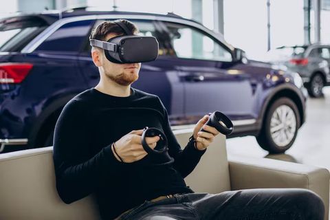
Virtual reality: The user enters a computer-generated environment that can replace much of the physical surroundings.
Mixed reality: Digital objects can appear to occupy physical space and interact with the user's environment.
Spatial audio: Sound is positioned within a three-dimensional environment so that it appears to come from particular directions or locations.
3D visualization: Digital models represent products, buildings, machinery, medical structures, or other objects in three dimensions.
Spatial interfaces: Users interact with digital information using gestures, eye tracking, voice, movement, or physical controllers.
Main Components
A spatial computing system usually combines hardware, software, data, and interaction technologies. Head-mounted displays provide visual output, while cameras and sensors collect information about the environment.
A spatial mapping system identifies surfaces and objects. Graphics engines then render three-dimensional content, while application software determines what the user sees and how the system responds.
Importance
Why Spatial Computing Applications Matter
Spatial computing applications can make digital information easier to understand when that information has a physical or three-dimensional relationship. A two-dimensional diagram of a machine, building, or anatomical structure may require mental interpretation, while a 3D representation can show position, scale, depth, and relationships directly.
The technology is being explored across manufacturing, engineering, healthcare, education, architecture, construction, retail, entertainment, logistics, aerospace, automotive development, and remote collaboration.
Manufacturing and Engineering
Engineers can use spatial computing to examine digital models alongside physical equipment. A digital component can be positioned over a real machine to support inspection, assembly planning, or design visualization.
In manufacturing environments, spatial systems can also display instructions near equipment or visualize factory layouts before physical changes are made.
Healthcare and Medical Education
Spatial computing can represent anatomy in three dimensions for education and visualization. Medical learners can examine digital anatomical structures from different angles instead of relying only on two-dimensional illustrations.
Clinical applications require appropriate validation, privacy controls, and regulatory consideration because medical use can involve sensitive information and safety implications.
Education and Training
Training programs can use immersive environments to recreate laboratories, industrial workplaces, emergency situations, historical environments, and technical procedures.
A trainee can interact with a simulated machine or environment without needing access to the physical equipment during every learning session. ISO/IEC 9234:2025 provides an information-modeling framework for VR, AR, and MR education and training systems.
Architecture and Construction
Architects and construction teams can use spatial computing applications to visualize buildings before construction or compare digital models with physical environments.
A building information model can be viewed at full scale, allowing users to examine room layouts, structural elements, equipment locations, and other design information in three dimensions.
Comparing Applications and Systems
| Application | Main Technology | Typical Digital Content | Practical Purpose |
|---|---|---|---|
| Manufacturing | AR/MR, sensors | Machine models and instructions | Assembly and inspection |
| Healthcare | 3D visualization, MR/VR | Anatomical models | Education and visualization |
| Education | VR/AR/MR | Simulations and 3D lessons | Training and learning |
| Architecture | AR/MR, 3D models | Building models | Design visualization |
| Automotive | VR/MR, 3D graphics | Vehicle models | Design and evaluation |
| Logistics | AR, computer vision | Routes and object data | Navigation and workflow |
| Entertainment | VR/MR, spatial audio | Interactive environments | Immersive experiences |
| Remote collaboration | AR/MR, shared spatial data | 3D objects and shared spaces | Distributed teamwork |
Challenges and Limitations
Spatial computing applications can require specialized hardware, substantial computing resources, accurate tracking, and carefully designed user interfaces. Poor tracking can cause digital objects to appear incorrectly positioned.
Privacy is another consideration because spatial systems can process information about rooms, surroundings, movements, eye direction, gestures, and other interaction data.
Physical safety and ergonomics also matter. Users may experience discomfort, visual fatigue, motion-related effects, or reduced awareness of their physical surroundings. ISO/IEC 5927:2024 provides guidance for safe immersion, setup, and use of AR and VR systems in consumer and enterprise environments.
Recent Updates
OpenXR and Cross-Platform Development
OpenXR 1.1 was released in April 2024 by the Khronos Group. The specification consolidated several previously separate extensions into the core specification and added improvements intended to reduce fragmentation between XR platforms.
This is relevant to spatial computing because developers can use standardized interfaces to work with different XR hardware and software environments rather than relying entirely on platform-specific development.
Spatial Anchors and Persistent Environments
In June 2025, the Khronos OpenXR Working Group released Spatial Entities Extensions for public review. The extensions address capabilities such as plane and marker tracking, spatial anchors, and persistence across sessions.
A spatial anchor is a digital reference point that allows virtual content to remain associated with a particular location in physical space. Persistent spatial information can support applications in areas such as training, collaboration, industrial visualization, and interactive environments.
Enterprise Spatial Computing
Enterprise development has also expanded through platform-specific capabilities. Apple's visionOS enterprise APIs include enhanced sensor access and shared coordinate-space capabilities for spatial applications.
These developments show a broader movement toward spatial computing applications that can work with real environments rather than functioning only as isolated virtual scenes.
Foveated Streaming
In 2026, Apple introduced foveated streaming capabilities for visionOS. Foveated streaming can stream high-quality content according to the approximate area where a user is looking, allowing demanding content to be processed on local or remote computing systems.
This approach can connect head-mounted devices with workstations, cloud systems, and other computing resources. It also illustrates how spatial computing is becoming connected with cloud and network-based processing.
Emerging Spatial Collaboration Standards
ISO/IEC CD 25768 is a 2026 committee draft addressing augmented mutual space representation for remote collaboration using AR, VR, and MR. The draft describes spatial relationships between objects and shared environments. Because it is still under development, it should not be treated as a finalized international standard.
Laws or Policies
International Standards
There is no single worldwide law specifically governing every spatial computing application. Requirements depend on the technology, industry, location, data involved, and intended use.
ISO/IEC 5927:2024 provides guidance concerning safe immersion, setup, and usage of AR and VR systems. ISO 9241-820:2024 addresses ergonomic considerations for interactions in immersive environments, including AR and VR.
These standards provide technical or ergonomic guidance rather than automatically becoming law in every country.
Privacy and Personal Data
Spatial computing can process personal and environmental information. Eye tracking, facial information, hand movements, voice, location, room geometry, and other sensor data may create privacy considerations.
In the European Union, organizations processing personal data may need to consider the General Data Protection Regulation (GDPR). Other regions have their own privacy frameworks, so compliance requirements can differ according to where data is collected and processed.
Workplace and Product Safety
Organizations using spatial computing in workplaces may need to consider existing occupational safety, electrical safety, accessibility, product safety, and equipment requirements. The relevant rules depend on the country and application.
For example, a headset used for industrial training may involve different safety considerations from a consumer entertainment application. Organizations should therefore evaluate the specific environment rather than assuming one regulatory framework applies universally.
Tools and Resources
Development Platforms
Spatial computing developers commonly work with 3D engines, XR development frameworks, device SDKs, computer-vision libraries, and graphics APIs. Unity and Unreal Engine are widely used development environments for interactive 3D applications, while OpenXR provides a cross-platform API standard for AR and VR devices.
3D Modeling and Digital Content
CAD software, 3D modeling applications, digital twins, and asset-management systems can provide the three-dimensional content used by spatial applications.
Common file and graphics technologies include glTF and other 3D formats designed to move digital assets between software systems.
Spatial Mapping and Sensors
Depth cameras, RGB cameras, inertial measurement units, eye trackers, hand tracking, and other sensors can provide environmental information. Spatial mapping software combines these inputs to estimate surfaces, positions, and movement.
Testing and Safety Resources
Developers can use device simulators, performance profiling tools, OpenXR validation resources, usability testing, and ergonomic guidance when evaluating spatial applications. ISO standards can also provide reference material for safe and human-centered immersive-system development.
FAQs
What are spatial computing applications used for?
Spatial computing applications are used for 3D visualization, training, engineering, manufacturing, healthcare education, architecture, construction, entertainment, remote collaboration, and other tasks involving digital information in physical or virtual space.
How do spatial computing applications work?
Spatial computing applications combine sensors, cameras, tracking, spatial mapping, software, and 3D graphics. The system interprets the surrounding environment and positions digital information according to the user's location and interaction.
What hardware is needed for spatial computing applications?
Hardware can include AR or VR headsets, mixed-reality devices, cameras, depth sensors, motion sensors, controllers, eye trackers, microphones, and compatible computing systems. The required hardware depends on the application.
What is the difference between spatial computing and virtual reality?
Virtual reality generally places the user inside a computer-generated environment, while spatial computing is a broader concept that can include AR, VR, MR, 3D interfaces, spatial audio, environmental mapping, and interaction between digital content and physical surroundings.
Are spatial computing applications used in industry?
Yes. Industrial applications include engineering visualization, equipment inspection, training, factory planning, maintenance guidance, design review, remote collaboration, and visualization of digital models alongside physical environments.
Conclusion
Spatial computing applications combine digital information with physical or virtual space through technologies such as AR, VR, MR, sensors, spatial mapping, and 3D graphics. They are being applied across engineering, manufacturing, healthcare, education, architecture, entertainment, and remote collaboration. Recent developments in OpenXR, spatial anchors, enterprise APIs, and cloud-based streaming are expanding interoperability and computing possibilities. Standards covering safety, ergonomics, and immersive education are also developing as spatial systems become more widely used.